Explore Our Latest News & Articles
Few stretches of the Intracoastal Waterway reward the cruising boater quite like the approach to Charleston. From the marsh-lined cuts near Isle of Palms to the broad, history-laden waters of Charleston Harbor, this section of the ICW offers stunning scenery, reliable anchorages, well-equipped marinas, and some of the most fascinating maritime history on the East Coast.

Isle of Palms -- ICW Mile 469
At Mile 456.7, the ICW passes through a land cut between Isle of Palms on the ocean side and Goat Island on the mainland side. Isle of Palms is well developed with golf courses, resort hotels, and restaurants making it a comfortable stop before the push into Charleston. The municipal Isle of Palms Marina near Mile 456 offers transient slips on floating docks and an easy-access fuel dock, with the well-stocked IOP Marina Outpost nearby for provisions.
For anchorage, Price Creek at Mile 448 is a local favorite with 7- to 8-foot MLW depths over a sandy bottom. Approach from the south -- approaching from the north at MLW, as little as four feet has been reported. Inlet Creek at Mile 461 is your last good anchorage before Charleston Harbor, with fair holding in at least 11 feet MLW. Plan to enter the harbor in daylight if possible.
Know Before You Go
The ICW between Mile 439 and Mile 456 is among the straightest stretches on the waterway, but don't let that breed complacency. Depths as low as 5.5 feet MLW have been observed at Mile 455, and charted depths along this stretch tend to run optimistic. Stay in the center of the channel, and at low tide be prepared to work side to side in search of good water.
CAUTION: Shoaling is active throughout this section and depths change constantly. Use current information and local knowledge when transiting. Check Waterway Guide Explorer for the latest alerts and buoy changes.
Charleston Harbor
This is a heavily trafficked commercial ship channel, stay to the edges until you clear the inlet jetties, and time your entry around the tides. Enter in daylight on your first visit, run your compass courses, and don't cut buoys. When coming in from the ICW, waiting until about two hours before high-water slack gives slower boats a nice boost upriver.
History runs deep here. Fort Sumter sits at the harbor entrance where the first shots of the Civil War were fired on April 12, 1861. You can anchor or beach on the western side, but note that all docking facilities at the fort are reserved for ferries and tour boats.
Cooper River & Downtown
On Charleston's eastern shore, Patriots Point is home to the permanently berthed aircraft carrier USS Yorktown, submarine USS Clamagore, and destroyer USS Laffey DD-736 that is well worth a visit if you have the time.
Charleston Harbor Resort & Marina offers floating docks, a 24-hour fuel dock, a water taxi into the city, and a free shuttle to a nearby grocery store making it a solid home base for exploring Charleston. On the western shore, the municipal Charleston Maritime Center puts you steps from the South Carolina Aquarium and the downtown trolley, though the current can be tricky.
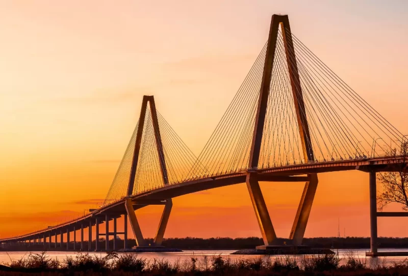
The iconic Arthur Ravenel Jr. Bridge spans the Cooper River with 186 feet of vertical clearance, welcoming virtually any masted vessel into the heart of the city.
Charleston rewards the boater who takes their time. Between the anchorages, the history, and the marina options, there's plenty here to justify a few extra days on the hook.
Want the full picture? Depths, bridge schedules, marina contacts, and mile-by-mile navigation notes for this entire region are covered in the Waterway Guide Mid-Atlantic Edition.


- 4,000 Marinas
- Thousands of anchorages
- Updated Charts
- Mile-by-Mile Navigation
- Highlighted Alerts & Cautions
- Full-Color Aerial Photographs
The Waterway Guide App Makes it easy to leave reviews, use our explorer, and view waterway guide materials all on the go!